![](/images/other/stat-length.png)
![Trail Walking Gemeinde Eben am Achensee - La Voie de l’Aigle : J5 - Photo](https://media.geolcdn.com/t/1900/400/0979ac60-95cc-4b4a-b5ac-19f4fe7653bc.jpg&format=pjpeg&maxdim=2)
La Voie de l’Aigle : J5
Greg813
User
![Length](/images/other/stat-length.png)
Length
7.6 km
![Max alt](https://static1.geolcdn.com/siteimages/upload/files/1508320355ic_sort_altitude_max_24dp.png)
Max alt
1962 m
![Uphill gradient](https://static1.geolcdn.com/siteimages/upload/files/1508320355ic_sort_den_pos_24dp.png)
Uphill gradient
709 m
![Km-Effort](/images/other/stat-length.png)
Km-Effort
16.2 km
![Min alt](https://static1.geolcdn.com/siteimages/upload/files/1508320355ic_sort_altitude_min_24dp.png)
Min alt
1261 m
![Downhill gradient](https://static1.geolcdn.com/siteimages/upload/files/1508320355ic_sort_den_neg_24dp.png)
Downhill gradient
462 m
![Boucle](https://static1.geolcdn.com/siteimages/upload/files/16400158638029165_repeat_loop_refresh_sync_direction_icon.png)
Boucle
No
Creation date :
2022-08-02 11:50:32.499
Updated on :
2024-09-15 07:27:04.618
![Walking](https://static1.geolcdn.com/sitytour/trail-icons/101.png)
2h12
Difficulty : Difficult
![Scan this QR Code to open this trail in the SityTrail application](https://capi.geolives.com/qq0zvz2zws4bq2lad0pu/sitytour/trails/3339282/qr.png?size=200)
FREE GPS app for hiking
About
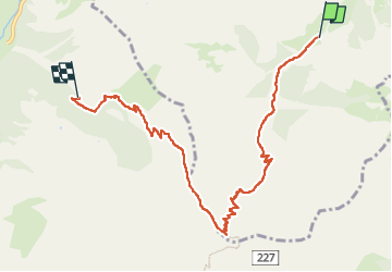
Trail Walking of 7.6 km to be discovered at Tyrol, Bezirk Schwaz, Gemeinde Eben am Achensee. This trail is proposed by Greg813.
Description
Trek de 8 jours dans le Tyrol autrichien avec Mettons le Monde en Marche. Parcours de la voie de l'Aigle de Langkampfen à Innsbrück avec nuits en refuge.
Etape 5 : Pertisau – Binsalm
Pour d'autres photos, voir le site de l'association :
https://mmm-rando.org/trek-la-voix-de-laigle-autriche-2022/
Positioning
Country:
Austria
Region :
Tyrol
Department/Province :
Bezirk Schwaz
Municipality :
Gemeinde Eben am Achensee
Location:
Unknown
Start:(Dec)
Start:(UTM)
697390 ; 5253240 (32T) N.
Comments
Trails nearby
![Trail Walking Marktgemeinde Vomp - La Voie de l’Aigle : J6 - Photo](https://media.geolcdn.com/t/375/260/5609364f-e5c4-47bf-bb71-733cbf599c19.jpg&format=jpg&maxdim=2)
![Walking Walking](https://static1.geolcdn.com/sitytour/trail-icons/101.png)
La Voie de l’Aigle : J6
Walking
Medium
Marktgemeinde Vomp,
Tyrol,
Bezirk Schwaz,
Austria
![](/images/other/stat-length.png)
17.1 km | 31 km-effort
4h 33min
![](https://static1.geolcdn.com/siteimages/upload/files/16400158638029165_repeat_loop_refresh_sync_direction_icon.png)
No
![Trail Walking Marktgemeinde Vomp - Lamsenjochutte falkenhutte - Photo](https://media.geolcdn.com/t/375/260/ext.jpg?maxdim=2&url=https%3A%2F%2Fstatic1.geolcdn.com%2Fsiteimages%2Fupload%2Ffiles%2F1553511878bg_sport_marche.png)
![Walking Walking](https://static1.geolcdn.com/sitytour/trail-icons/101.png)
Lamsenjochutte falkenhutte
Walking
Medium
Marktgemeinde Vomp,
Tyrol,
Bezirk Schwaz,
Austria
![](/images/other/stat-length.png)
13.4 km | 25 km-effort
6h 19min
![](https://static1.geolcdn.com/siteimages/upload/files/16400158638029165_repeat_loop_refresh_sync_direction_icon.png)
No